
Georgia Neighbors by Parcel and Source
A Georgia block is best read as a set of parcels and civic records, not as a verified list of households. County GIS can show which parcels touch an address; assessor cards give tax-roll and mailing fields; voter records serve election functions and have specific limits. Official neighborhood maps can help locate a civic group, but they do not provide a membership roster. The coverage table separates what each route can show from what it cannot prove about people who live nearby.
| Record Source | Block-Level Detail | How to Reach It |
|---|---|---|
| County GIS parcels | Parcel shape, adjoining lots, address and map layers | County viewer; Fulton is a representative example |
| Assessor / tax card | Tax-roll owner, situs, mailing and parcel fields | DOR links to county systems |
| Recorded deed index | Transfer parties and legal land references | GSCCCA and county clerk |
| Voter records | Public registration fields and district context | MVP or SOS order process |
| Official civic maps | Neighborhood, NPU or registered-organization contact layer | Atlanta NPU directory or Savannah Open Neighborhoods |
| Historical directories | Dated name-to-address or address-to-name entries | Libraries, archives and DLG volumes |
An owner name is not an occupant count. Georgia tax and map records can point to an owner or tax mailing destination, which may be an entity or another place. A person’s presence on a voter file is governed by election rules, and absence from a map or list does not mean the home is empty. Keep every address tied to its field label and record date.
Map Georgia Neighbor Parcels Step by Step
Use parcel geometry to move from one known address to the surrounding land. The county GIS view can reveal adjoining polygons and their parcel IDs. Fulton County’s PropertyMapViewer parcel layer is a fully inspected example, not a statewide viewer; it includes address, owner, mailing address, tax district, value, subdivision, lot and block fields, along with map-query tools.
| GIS search input | Field type | When it helps |
|---|---|---|
| Owner name | Text | Find a tax card when the county supports name search |
| Street number, name and suffix | Text or full address | Locate a known site or compare address variants |
| Parcel or alternate ID | Text | Retrieve a known county account |
| Subdivision, lot and block | Text or dropdown | Match a platted parcel across map and deed records |
| ZIP or tax district | County-specific | Use only when the local portal offers a filter |
| Map or draw control | Map tool | Select adjoining parcel geometry |
Follow the property fields in order, and stop at the parcel boundary before drawing a conclusion about a household:
- Search the address in the county’s GIS or parcel viewer and confirm the county.
- Open the target parcel, record its ID and geometry, then query or select adjoining polygons.
- Open each parcel card and keep owner, situs address and tax mailing address in separate fields.
- Compare district, subdivision, lot and block fields to spot a boundary that crosses the street.
- Use the Georgia street directory for a full named-street record chain.
The GIS layer can query shapes and attributes, but each county publishes a different set of layers. A parcel map helps define the block’s physical edge; it does not show who is inside a building or whether a tax-roll owner lives there.
Georgia Neighbor Parcel Fields
The Fulton County map service offers a detailed sample of how a county parcel layer can separate an address from owner-mailing data. Its fields include parcel ID, tax year, address components, owner and owner-mailing fields, district, assessed and appraised values, exemptions, acreage, neighborhood, subdivision, lot and block. It also supports map query, geometry and SQL operations. This is a representative inspection for understanding the method, not a claim that every Georgia county offers the same field names or tools.
When comparing adjacent Georgia parcels, preserve the tax year and exact field label. A parcel may list an LLC, estate, trust, lender or institution as owner; the mailing destination may be elsewhere. Assessed value, homestead flags or unit counts describe the tax record, but do not establish who lives nearby. If the map card and deed differ, inspect the recorded instrument through GSCCCA or ask the county custodian.
The Fulton parcel layer details show the geometry and owner/mailing fields used in this example.
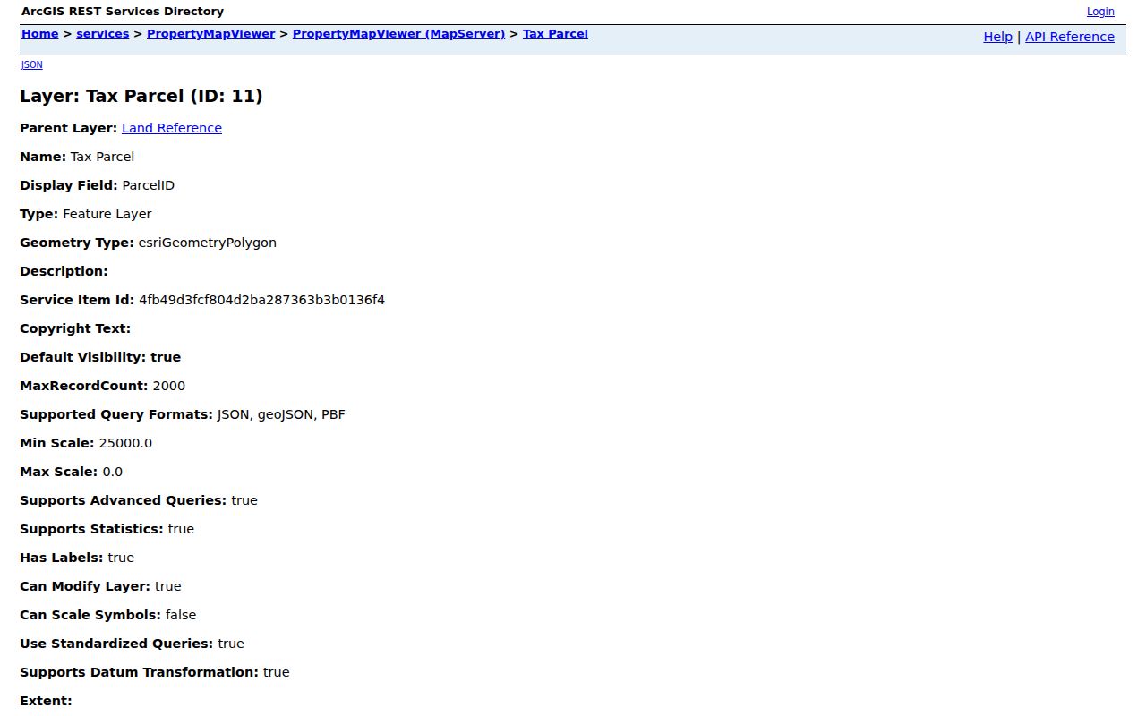
The sample makes clear why a property address and tax mailing address should not be combined into one claim about a household.
Georgia Block Records Across Boundaries
Two parcels on one Georgia street can carry different municipal, county, ZIP, tax-district, school or neighborhood-planning values. A jurisdictional seam can explain why one lot routes to a city permit office while the next uses a county department. It is a records boundary, not proof that nearby people belong to separate social groups. Compare parcel polygons and the official district layer before assuming a continuous street has one custodian.
Postal city labels add another layer. Georgia ZIP codes are delivery areas, not legal municipalities, and a USPS city name can differ from the city shown by local GIS. Keep the postal label, legal municipality, county, ZIP, tax district and parcel ID in separate fields. This typed-address habit makes a Georgia neighbor lookup less likely to join records that only look alike because of a shared street name.
Georgia Voter Records and Block Privacy
Georgia My Voter Page helps a voter check personal registration status, polling place, sample ballot and elected officials. Ordered voter files can include residence street components, ZIP, precinct and district descriptions, but the Secretary of State restricts bulk-file use to voter-registration purposes. Public files omit full birth date, Social Security number, driver-license number and telephone. They are not a household roster or a reason to compile people by block.
VoteSafe and Safe at Home protect qualifying voters and survivors by sealing or substituting address information. A protected record may not appear in an ordinary search. Do not try to reconstruct a protected location through a neighboring parcel, directory or mailing field. If a lawful election task requires a file, follow the current Secretary of State order instructions and keep the data within its stated use.
Georgia Neighbors and Civic Contact Maps
Official neighborhood tools help residents find civic contacts without exposing private member lists. Atlanta’s city-planning page describes 25 Neighborhood Planning Units and more than 240 neighborhoods, with maps, NPU-by-neighborhood lookup, meeting information and organization contacts. Savannah’s Open Neighborhoods map, launched in 2017, shows neighborhood areas, registered association contacts, Aldermanic Districts and amenities. Georgia has no statewide directory of every neighborhood association, congregation, civic club or HOA, and neither city map is a membership roster.
Atlanta NPU Directory
Atlanta’s official NPU page links neighborhood groupings, maps, meetings and civic contacts. Use it to identify the correct local planning unit.
Savannah Open Neighborhoods
Savannah’s searchable neighborhood map includes registered organization contacts and district context. It does not list private membership.
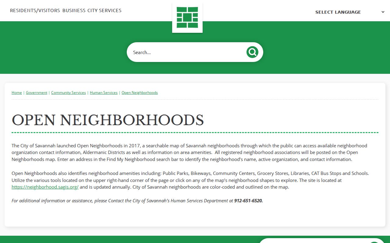
Use the map to find a public civic contact or district, not to infer a private person’s affiliations.
Historical Georgia Neighbors in Directories
Historical directories can add a dated name-and-address layer when researching a block’s past. The digitized Atlanta 1891 volume includes terse entries with “r” for residence, “bds” for boards and “wks” for works. Those marks matter: a person boarding at an address is not necessarily a property owner or a permanent household member. Compare nearby editions and the same street entry before treating two appearances as one continuous residence.
Georgia’s historic street names also affect searches. DLG materials on Atlanta street changes document McDonough to Capitol, Grubb to Poplar and Magazine to Magnolia. A map, directory, plat or municipal record can bridge an old name to a current parcel. Libraries and archives hold local volumes; digital OCR can miss names, so check the scanned page image where available.
Georgia Neighbor Lookup Privacy Limits
Public Georgia records do not create a verified roster of every person on a block. An assessor names a tax-roll owner, a deed names parties to a transfer, and a voter file contains selected fields under an election-use restriction. Those systems do not establish household membership or current physical presence. VoteSafe and Safe at Home can protect qualifying addresses, while sealed court, juvenile, adoption and other restricted records may not appear in ordinary search results.
Official sources have a named custodian, a record purpose and a way to inspect or correct the underlying entry. Commercial neighbor-search tools may combine old public and licensed data into a profile, but the result may be stale or merge people with similar names. Compare a claim with the issuing Georgia office rather than treating a commercial summary as a source record. Use civic contact maps for a public organization contact, not for private member details.
| Source type | What it gives | Limit to keep in view |
|---|---|---|
| Official parcel and deed records | Dated property fields and recorded transfer parties | Do not prove who occupies a home |
| Official voter systems | Registration, district and permitted public fields | Purpose restrictions and protected addresses apply |
| Civic neighborhood maps | Public boundaries, meetings or organization contacts | Not a private membership roster |
| Commercial neighbor profiles | Combined clues assembled from multiple sources | May be stale, incomplete or mismatched |
For an existing Georgia government record that is not on a portal, send a narrow request to the custodian under the Georgia Open Records Act, O.C.G.A. §§50-18-70 et seq. The office generally responds within three business days with records, timing, estimated cost or an exemption explanation; it need not create a new report.
Lawful use. Keep a Georgia neighbor lookup to a legitimate personal or civic purpose and use the least information needed. Stalking or harassment is addressed by Georgia law, including O.C.G.A. §§16-5-90 and 16-5-91.