
Georgia ZIP Code Coverage Map
Georgia ZIP codes cluster in the 300xx–319xx and 398xx–399xx families. Those prefixes give a broad regional orientation, not a list of current five-digit codes or a legal boundary. Atlanta-area routes can use postal names that differ from a town or county, and rural routes cross local lines. The table summarizes only the prefix-level geography identified in the research. Use USPS for a current result tied to a full street address.
| ZIP family | Broad Georgia orientation | Post office check | Notes |
|---|---|---|---|
| 300xx | North, east, and west Atlanta metro | Verify exact address in USPS | Postal city can differ from municipal limits. |
| 301xx | Northwest and west metro, Rome and Cartersville areas | Verify exact address in USPS | County and city lines cross postal service areas. |
| 302xx | South metro and central counties, including Jonesboro, McDonough, Griffin, and Newnan areas | Verify exact address in USPS | Confirm each five-digit code. |
| 303xx | Atlanta city and metro routes | Verify exact address in USPS | Includes unique, institutional, and PO-box routes. |
| 304xx–306xx | East and northeast Georgia, including Statesboro, Vidalia, Athens, and Greensboro areas | Verify exact address in USPS | Rural routes and postal names vary. |
| 307xx–309xx | Northwest Georgia and Augusta/central-east areas | Verify exact address in USPS | Municipal and county limits may not follow the postal label. |
| 310xx–312xx | Macon and central Georgia | Verify exact address in USPS | Some 311xx routes are Atlanta unique or PO-box routes. |
| 313xx–315xx | Savannah, Brunswick, and coastal/southeast routes | Verify exact address in USPS | Historic, county, and city names may coexist. |
| 316xx–317xx | South Georgia, including Valdosta, Tifton, and Albany areas | Verify exact address in USPS | Broad orientation only. |
| 318xx–319xx | West Georgia, especially Columbus and LaGrange areas | Verify exact address in USPS | 319xx includes unique routes. |
| 398xx–399xx | Southwest and special routes, including Albany and Bainbridge regions | Verify exact address in USPS | Check current designation and route type. |
This is not a complete Georgia ZIP-code directory. The research did not locate a dated USPS extract listing every current, PO-box, unique, institutional, military, or discontinued code. The post-office field must be confirmed for an exact address; a prefix cannot name the serving office or tell which parcel sits inside a municipality.
Three USPS Search Modes
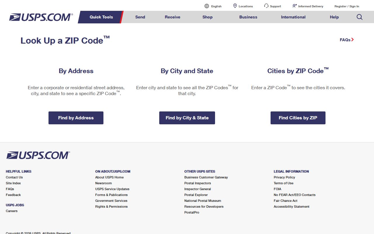
The USPS lookup has three separate ways to resolve postal geography. By-address search returns a delivery ZIP and city result. City-and-state search returns ZIPs for that postal city, which can be ambiguous when several codes serve it. Cities-by-ZIP returns recommended or recognized postal city names. USPS cautions that an address result does not confirm that a named person or business is there and does not guarantee a business location.
| Search mode | Fields and result | Use |
|---|---|---|
| By address | Street plus city/state, or street plus ZIP; returns postal city and delivery ZIP. | Best for checking one full address. |
| City and state | Postal city and state; returns a list of ZIPs for that place name. | Use a full street address when one city has several codes. |
| Cities by ZIP | Five-digit ZIP; returns recognized or recommended city labels. | Compare labels without treating them as legal boundaries. |
The USPS ZIP Code Lookup screen shows these options. Its address mode is a routing check, not an occupancy search. Keep the exact input and result together when a postal city seems to conflict with a tax card or a directory.
The USPS lookup screen is the official starting point for an address, city/state, or cities-by-ZIP search. The USPS form is the source for these three modes.
Use the response to confirm postal formatting, then return to the record custodian for a parcel, tax, or registration question. A delivery label alone does not show who lives at the address.
Georgia Postal Labels and Census Areas
A postal city is a delivery label; it is not a legal municipality. Census guidance on USPS and Census city names also warns that ZIP areas can cross city and county lines, while a ZIP Code Tabulation Area is a statistical approximation rather than a USPS ZIP. For a parcel question, use county or city GIS to identify legal jurisdiction. Keep the postal city returned by USPS in a separate field instead of replacing the municipality with it.
The distinction matters in Georgia’s large metro areas, along the coast, and where municipal limits meet unincorporated territory. A March 2026 report on Sandy Springs postal labels described a naming discussion and a 30092 exception; a label change does not move a parcel or redraw a city line. Treat that as a dated example and check the live USPS result for any address.
The USPS City State Product maps ZIP codes to preferred and alternate city names and county information. Its monthly update makes it useful for a date-stamped comparison, but it is a large national product rather than a simple fixed state list. The USPS product page describes the fields, and the monthly-product screenshot shows how city and county labels compare.
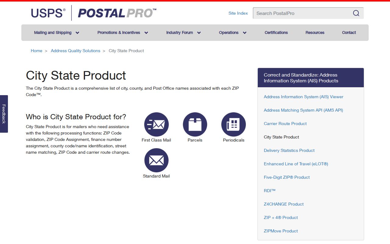
That product can help explain why two records carry different city labels, but current parcel geography still comes from the local map and address custodian. Record the source date so later updates do not overwrite the older value.
Search Georgia Records by ZIP
A ZIP can help narrow a record search only when the source actually supports that field. County tax systems differ, and some show a ZIP on a parcel card without offering a ZIP-wide query. The Secretary of State’s voter-file columns include city and ZIP, but ordered files are for voter-registration use. My Voter Page is a dynamic person-level service, not a statewide list of everyone at one postal code. Start by confirming which kind of record the question needs.
- Enter the full address in USPS and save its returned postal city and ZIP as a dated delivery result.
- Use DOR’s county links to identify the tax office for the parcel’s county, then read that portal’s actual search fields.
- If a county portal offers ZIP, use it only for the parcel records the system describes. Otherwise search the full street address or parcel ID.
- For an election record, use My Voter Page for an individual self-check or ask the registrar about official voter-file access and its limits.
When a postal area has been narrowed to a specific road or parcel, follow the Georgia street directory’s address workflow. A ZIP match is a routing clue, not evidence that a named person lives at a particular address.
Georgia ZIP Fields in County Portals
Georgia has no uniform statewide assessor search and no common ZIP filter across its 159 counties. The DOR property-record directory points to the county tax system, which may be qPublic, a custom property card, a map viewer, or separate tax and GIS tools. Search fields can include owner name, street address, parcel or alternate ID, map selection, subdivision, lot, block, or tax district. ZIP may appear only as a result field.
A GIS layer can add parcel geometry, address components, subdivision, lot and block, land use, or district fields, but each county decides what to publish. A ZIP value does not make a county database a ZIP directory. If the portal has no ZIP search mode, use address or parcel controls and leave the broader postal area unresolved rather than treating a map boundary as a postal boundary.
The county map can answer where a parcel is administered, while USPS answers how a delivery address is labeled. For a street crossing two jurisdictions, save both results and the dates they were checked. Do not infer the city office from the postal city alone.
Georgia Address Types Kept Separate
One Georgia address can carry several correct place labels at once. A property card may show a situs location and a different tax mailing address; an older directory preserves the name printed in its edition; a voter or court entry has its own filing purpose. Store the fields by type so a change in postal city does not erase the legal municipality, county, or historic wording.
- ZIP+4
- The five-digit ZIP followed by four digits that further sort delivery within the ZIP area.
- PO-box ZIP
- A postal code used for box delivery rather than ordinary street delivery; confirm its current role with USPS.
- Unique ZIP
- A code assigned to one organization or high-volume recipient, not a general city boundary.
- Carrier route
- A delivery route identifier within postal operations; it is not a municipal or parcel line.
For a record note, preserve `situs_address`, `mailing_address`, `directory_address`, `postal_city`, `legal_municipality`, `county`, `ZIP`, and `parcel_id` as separate values when present. Keep the printed historic form as well. This makes conflicts visible instead of forcing a postal name to stand in for every address type.
Georgia ZIP Code Directory Coverage
A complete current five-digit table requires a dated USPS City State Product or other official address-information extract. The research inspected the public product description and live lookup but did not locate a state-only downloadable list covering every active, PO-box, unique, institutional, military, and discontinued code. This prefix summary is therefore an orientation tool, not a searchable inventory of every Georgia delivery route.
For a historical question, the USPS post-office-by-ZIP history can help track past post-office names and routes. For statistical maps, the 2026 Census gazetteer files include ZCTAs, which approximate ZIP areas and are not USPS delivery codes. USPS also offers ZIP Code Boundary Data. Keep the product date, source, and any code status beside a copied row; do not silently treat an older ZIP as current.
The missing state extract is a research limit, not proof that a ZIP or post office does not exist. A fresh official product can fill the list, while a live USPS address lookup remains the better check for a single location.
Georgia ZIP Codes vs City Limits
A USPS ZIP and a legal city limit answer different questions. A Georgia address can carry a postal city name that does not match its municipality, and one ZIP may cross a city or county line. The Census Bureau’s city guidance explains why postal-city labels are not legal municipal geography; ZCTAs are statistical approximations rather than USPS ZIPs. For a boundary check, use the local parcel or municipal map and record the USPS label separately.
For one address, first confirm the delivery ZIP in USPS, then identify the county and municipality through local GIS. Compare the assessor’s situs and mailing fields rather than choosing one as the “real” address. If the local tax portal and postal response differ, retain both with their source dates. A postal label change does not itself move the parcel or alter which city or county keeps its land or permit records.
- ZIP
- A USPS delivery area identifier; it is not an incorporated-place boundary.
- City label
- The recommended postal city name associated with delivery, not necessarily the legal municipality.
- ZCTA
- A Census statistical geography built to approximate ZIP patterns, not an active postal route.
For a parcel-by-parcel look at a street once the ZIP has done its routing work, use the address-based source rather than expanding the ZIP into a people list. This keeps the Georgia ZIP code directory grounded in what the postal and local records actually say.